File:Wind placement IsisDelta.png
Jump to navigation
Jump to search
No higher resolution available.
Wind_placement_IsisDelta.png (327 × 218 pixels, file size: 141 KB, MIME type: image/png)
Summary[edit]
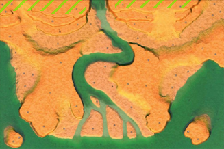
Good wind farming area on map IsisDelta
Licensing[edit]
This is a screenshot of Zero-K or related infrastructure. Refer to the GitHub repositories for the license of individual elements depicted in the screenshot.
File history
Click on a date/time to view the file as it appeared at that time.
| Date/Time | Thumbnail | Dimensions | User | Comment | |
|---|---|---|---|---|---|
| current | 04:32, 18 August 2018 | | 327 × 218 (141 KB) | Histidine (talk | contribs) | Good wind farming area on map IsisDelta |
You cannot overwrite this file.
File usage
The following page uses this file: