Loading...
  OR  Zero-K Name:    Password:   
Back to List

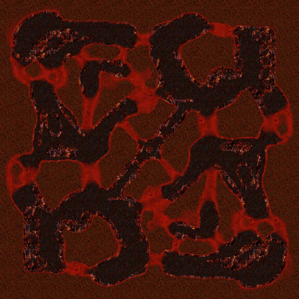
Coagulation Marsh 0.2

By Anarchid
Rating:

This land coagulated from the blood of the deflated, and yet now it is contested from sea of the berated, from the ground of infiltrated, and from air of devastated. You are gonna lose your mind tonight, in oceans of blood.
Size: 12 x 12

PLAY ON THIS MAP


Downloads: 9
Manual downloads:
http://springfiles.zebar.de/maps/coagulation_marsh_0.2.sd7
http://spring1.admin-box.com/maps/coagulation_marsh_0.2.sd7
http://api.springfiles.com/files/maps/coagulation_marsh_0.2.sd7


Preview
Filter:    Player:  
sort


9 years ago
Look, i can into maps, like @ArchShaman!
+6 / -0
9 years ago
+2 / -0


9 years ago
Makes me wished I knew how to make real maps. What tools do you use to make maps like this? I want to make an attempt at a real map now :/
+0 / -0


9 years ago
Blender.

I can hand you the source file if you want.
+2 / -0
Blender eh? I'll have to remember that.

I wasn't even aware you could make maps in blender. Please do share. :) I'd love to give it a try. I got some unused texture files laying around somewhere I haven't quite made metal/height maps for (which doing it by hand is the hardest part imo -- especially for balance!). Might be interesting to give making skirmish maps a chance instead of making silly maps.
+0 / -0
9 years ago
You can sculpt a map in blender and render that as a heightmap. If you already have a texture you could try using a greyscale version of it with the displace modifier to see what it comes out like.
+0 / -0
My approach is a little more sophisticated byt yeah, that's the grit of it. You sculpt a 3d mesh, and the pixels come out to match it.

The actual diffuse terrain texture comes from a procedural Cycles material and is based on incline (Z normal) and altitude of each vertex.

For terrain and Spring, an extra care had to be taken to properly calculate the x/y/z aspects of the map, e.g. so that it appears as tall in game as it does in Blender. In this case, it's a 12x12 map with -50 to +200 heights, mapping between 0.0 and 1.0 blender units and being (iirc) 16 BU wide. There still remained some imperfections so i had to adjust the altitude by 5-6 elmo in map's config file.

Here's the .blend (actually for an unreleased version).

There are three materials in that file, a heightmap (for obvious purposes), a diffuse (also obvious) and an "attribmap" that could be later used for splat textures, terrain types, and so far i've mostly been using it to map traversability, e.g. for visual representation when those fords are exactly depth 5, so they slow land units very little while still allowing ships to pass.

The diffuse would come out at 6000+ pixels, so you might require a "render regions" plugin to not cause hilarious ram excess when rendering that.

+1 / -0

9 years ago
So the idea is the land is made of coagulated blood, that's right?
+0 / -0
Kinda. Don't get too thick on that kind of macabre geology.

Aside from coagulated bedrock there would be some kind of mineral sediment, e.g. from the blood-seabirds doing what they do. Also depending on the age and precipitation, different kinds of chemicals would be washed out after the bacterial bloom ate what it could, generating actual soil in the deeper spots, and leaving mineralized rock in other places. The texture used for island flat areas in this version is that of granite, which is incorrect, because granite is a metamorphic rock, and all layers on this map would be sedimentary.

Given that the actual water is not nearly opaque enough to be blood, and working from assumption that it actually contains blood, it would mean that it's a blood/saltwater mix of some kind. Generally, all kinds of microorganisms would simply consume all those proteins, and leave the water clean after a while, so there might be a fresh source of that.

Alternatively, some bedrock could actually have pre-existed, and the areas around would be coagulated sediment. I think i'll go for this in the next version, making middle areas less bloody, and side areas more bloody. Just need to figure out a proper cycles program for that, because merely altitude will likely be insufficient.
+2 / -0
By the way, this video is much better at explaining how to make height maps. link
+0 / -0
upgrade complete.

P.S. as long as we're linking videos...


+1 / -0
Back to List